
BULLETIN
Tropical Storm Idalia Intermediate Advisory Number 7A
NWS National Hurricane Center Miami FL AL102023
700 AM CDT Mon Aug 28 2023
…IDALIA FORECAST TO BECOME A HURRICANE WHEN IT NEARS WESTERN
CUBA LATER TODAY…
…LIFE-THREATENING STORM SURGE AND DANGEROUS WINDS BECOMING
INCREASINGLY LIKELY FOR PORTIONS OF FLORIDA…
SUMMARY OF 700 AM CDT…1200 UTC…INFORMATION
———————————————-
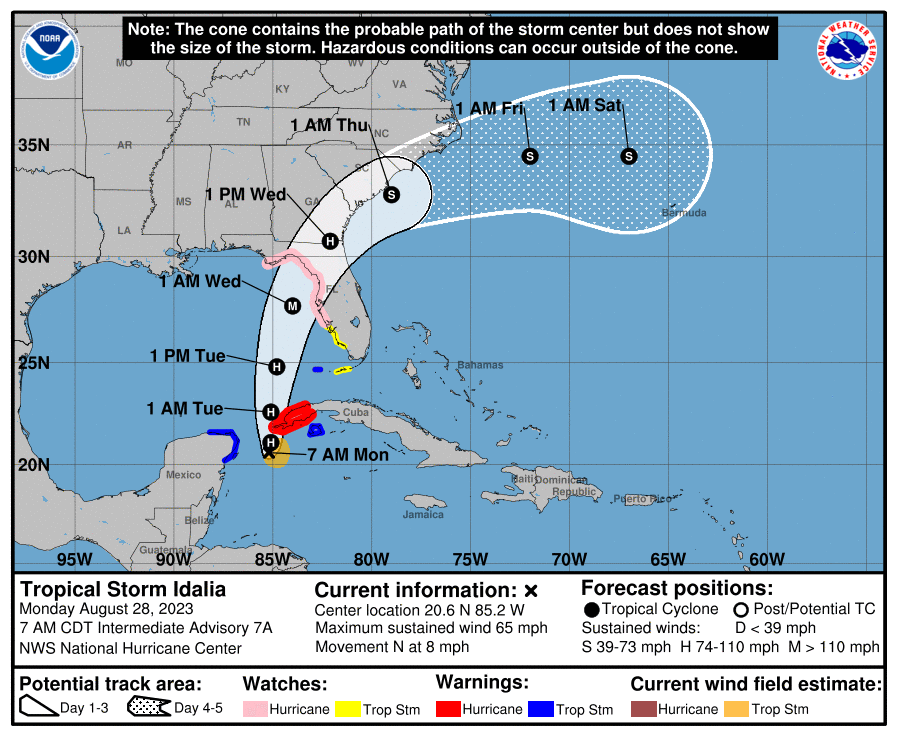
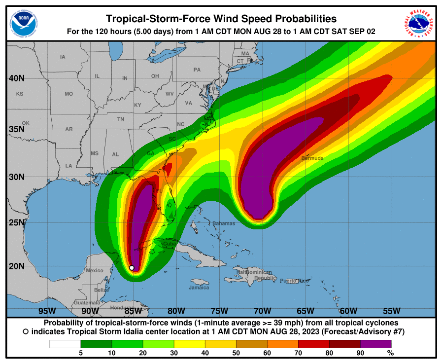
LOCATION…20.6N 85.2W
ABOUT 90 MI…150 KM S OF THE WESTERN TIP OF CUBA
MAXIMUM SUSTAINED WINDS…65 MPH…100 KM/H
PRESENT MOVEMENT…N OR 360 DEGREES AT 8 MPH…13 KM/H
MINIMUM CENTRAL PRESSURE…989 MB…29.21 INCHES
DISCUSSION AND OUTLOOK
———————-
At 700 AM CDT (1200 UTC), the center of Tropical Storm Idalia was
located near latitude 20.6 North, longitude 85.2 West. Idalia is
moving toward the north near 8 mph (13 km/h). A northward motion
is expected through tonight, followed by a faster north-northeast
motion on Tuesday and Wednesday. On the forecast track, the center
of Idalia is forecast to pass near or over western Cuba tonight,
over the extreme southeastern Gulf of Mexico by early Tuesday, and
reach the Gulf coast of Florida on Wednesday.
Maximum sustained winds are near 65 mph (100 km/h) with higher
gusts. Idalia is forecast to become a hurricane later today and a
dangerous major hurricane over the northeastern Gulf of Mexico by
early Wednesday.
Tropical-storm-force winds extend outward up to 70 miles (110 km)
from the center.
The latest minimum central pressure estimated from data from an Air
Force Reserve reconnaissance aircraft is 989 mb (29.21 inches).
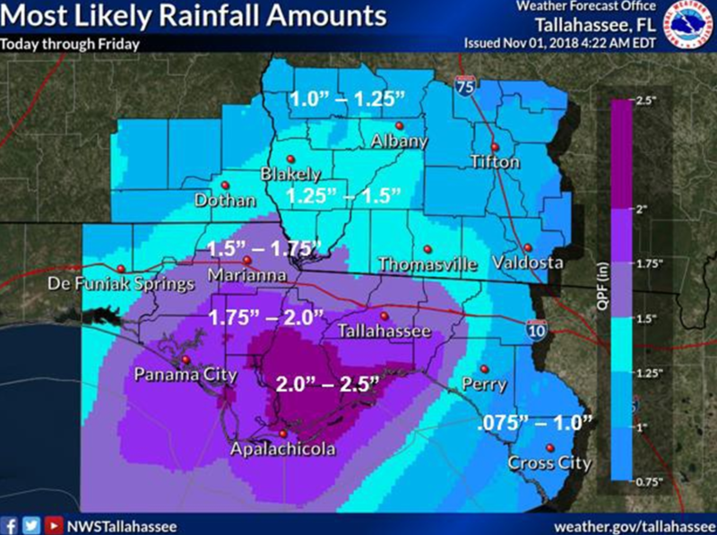
RAINFALL: Idalia is expected to produce the following rainfall
amounts:
Portions of the eastern Yucatan: Additional 1 to 2 inches.
Western Cuba: 4 to 7 inches, with isolated higher totals of 10
inches.
Portions of the west coast of Florida, the Florida Panhandle,
southeast Georgia and the eastern Carolinas: 4 to 8 inches from
Tuesday into Thursday. Isolated higher totals of 12 inches possible,
primarily near landfall in northern Florida.
This rainfall may lead to flash and urban flooding, and landslides
across western Cuba.
Areas of flash and urban flooding, some of which may be locally
significant, are expected across portions of the west coast of
Florida, the Florida Panhandle, and southern Georgia Tuesday into
Wednesday, spreading into portions of the eastern Carolinas
Wednesday into Thursday.
Be the first to comment