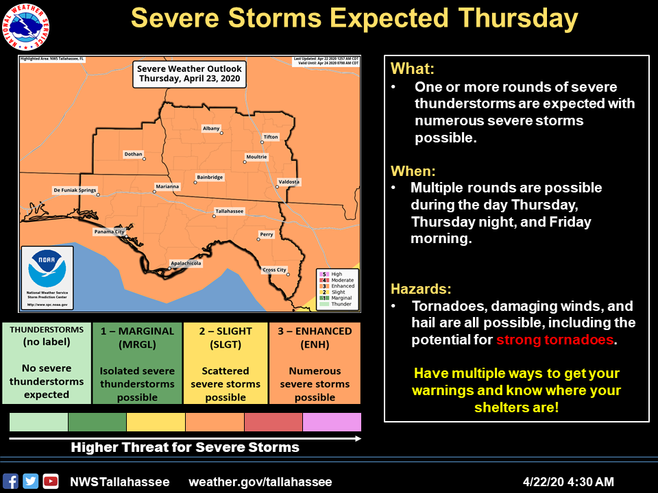
Bottom Line:The confidence in severe weather occurring across the Tri-State region Thursday and Thursday night continues to increase. All severe weather hazards are in play, including the threat of strong tornadoes. Confidence is low at this time on exact timing with two rounds possible; one round on tap for late morning through the afternoon hours then round two in the overnight hours. Additional refinements in timing and intensity will be made with future forecasts heading into Thursday.Overview:An enhanced risk for severe weather is forecast by the Storm Prediction Center for our area Thursday and Thursday night. A powerful low pressure system and cold front will impact the southeast US Thursday into early Friday morning. A line of strong to severe thunderstorms will move across the area Thursday morning into the afternoon. Another round is possible overnight Thursday night. A lingering severe threat may exist in the eastern Big Bend counties early Friday morning as the cold front slows down and stalls south of our area. All severe weather hazards are possible, including strong tornadoes. Rainfall totals from this system will be 1-3″ with the heavier amounts across southwest Georgia. Localized flooding could occur in these areas due to recent heavy rainfall. River basins could experience continued rises in river levels, including the Flint, Apalachicola, and Chattahoochee basins.


Be the first to comment