
The National Weather Service in Tallahassee has issued an alert for southwest Georgia related to the potential for heavy rains and flash flooding. Here is the latest:
Bottom Line:
The threat for flash-flooding across the area remains isolated but it will continue to increase into the weekend as additional rainfall falls, especially across western portions of the Florida Panhandle.
Overview:
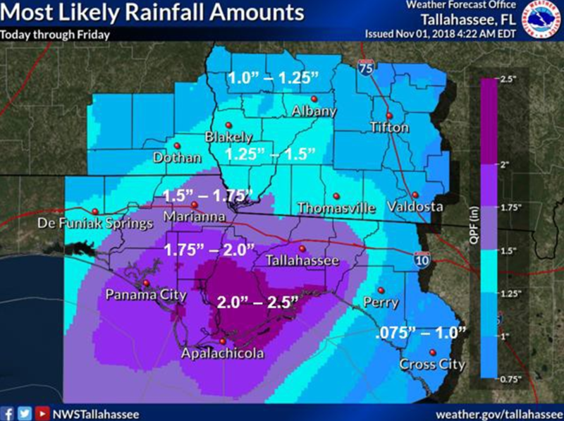
The heaviest rain over the last day has fallen in western portions of the Florida Panhandle (see graphic “Estimated Rainfall Totals”) and additional rainfall over the next several days will continue to increase the risk for flash flooding for isolated locations. As of this moment, the most favored locations for flash flooding will be across western portions of the Florida Panhandle. Widespread shower and thunderstorm activity is expected this morning and into the early afternoon with a reduction in shower and thunderstorm coverage possible later this afternoon. Confidence in this break this afternoon is low and the possibility for showers and t-storms to continue through the afternoon still remains. After this potential break, we’re expecting another round of rain to develop across the area late Friday night into Saturday morning. The wet pattern continues into Sunday morning with additional rainfall expected overnight Saturday. Rainfall forecasts have also begun to increase across portions of the Big Bend near Taylor county with recent updates.
Through Sunday morning, our forecast is calling for widespread rainfall amounts of 2 to 4 inches with higher amounts expected over the western Florida Panhandle where an additional 4 to 6 inches is possible. Some isolated locations could receive up to 10 inches of additional rainfall by Sunday morning.
Lastly, there is a marginal risk for an isolated strong storm or two across the region today. The main threat will be damaging winds but an isolated tornado, especially near the coast if a waterspout moves ashore, can’t be ruled out.


Be the first to comment