
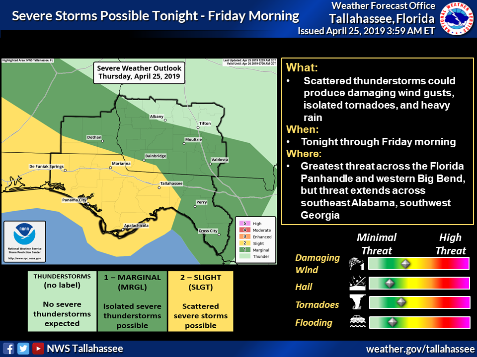
The storm system that is moving into southwest Georgia Thursday night/Friday morning is expected to bring a severe weather threat. Here’s the latest:
What: Scattered thunderstorms with a few severe storms possible. Damaging straight line wind is the main threat, although a tornado or two cannot be ruled out. Locally heavy rain is also possible.When: Thursday night through mid-morning Friday.Where: The greatest threat is across the Florida Panhandle and western Big Bend, but the threat extends across southeast Alabama and into southwest Georgia as well.Impacts: Sporadic impacts to trees and power lines is the most likely impact. Greater impacts are possible if a tornado or two develops, but we are currently not expecting widespread severe weather. Isolated pockets of minor flooding in poor drainage areas are also possible with locally heavy rain in a brief period of time.



Be the first to comment