
From the National Weather Service:
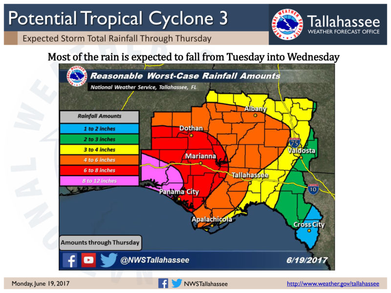
SYNOPSIS: A strong low pressure system will move eastward through the southeast United States over the next 24 hours and bring a chance for severe weather to the area.
THREAT: Main threat will be damaging winds with a lesser threat of an isolated tornado and large hail.
TIMING: For areas along and west of Panama City Florida to Cuthbert Georgia: Possibly two rounds of severe weather is expected. The first round is expected early in the evening in the form of a squall line. An isolated severe storm will be possible with this first line. A stronger squall line, and thus higher probability of severe weather, is expected to develop along the cold front in the late evening and track eastward across this area. Severe threat will decrease in the early morning hours.
For areas along and east of Panama City Florida to Cuthbert Georgia: One round of severe weather is possible in this area beginning after midnight as the squall line tracks eastward. Severe threat will decrease from west to east as the line moves through.


Be the first to comment