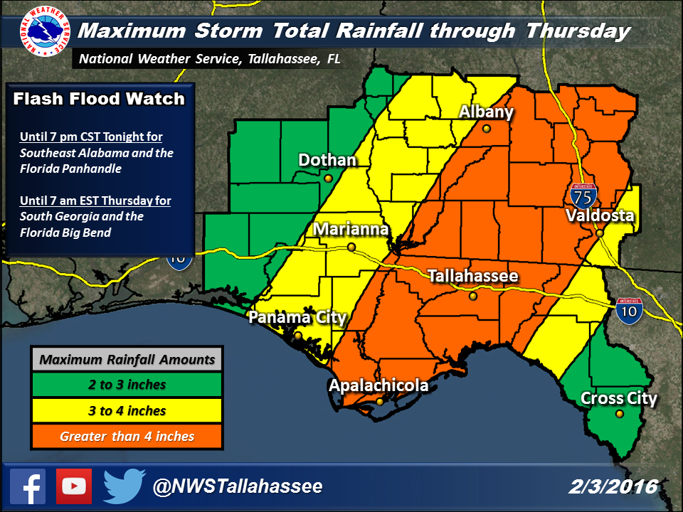
The National Weather Service issued a flash flood watch for most of the region for today and
this evening.
While 2-4 inches of rain will be common across the area by Thursday afternoon,
some locally heavier amounts are likely, especially across South Georgia
and the Florida Big Bend. These heavier amounts could cause flash
flooding, especially in urban areas. Additionally, the widespread
rainfall will result in steady rises on several of the rivers across our
region.
In addition to the heavy rainfall threat, there is also a marginal risk
for severe storms today ahead of the cold front. Damaging winds and
isolated tornadoes are possible with the strongest storms.

Be the first to comment