
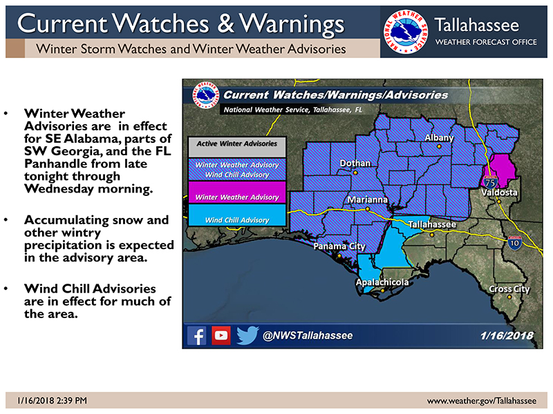
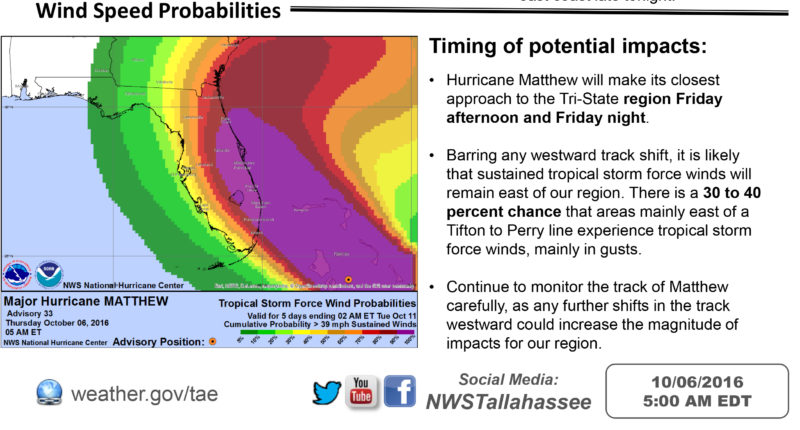
The storm system that has developed in the Northern Gulf of Mexico continues to grow into a significant issue for the Gulf Coast. However, the initial reports that predicted the system would impact southwest Georgia have shifted, moving the landfall farther west. If the predicted pattern holds, southwest Georgia will see 1-2″ of rain, while the western Panhandle of Florida along with Louisiana will get much more.
PTC 2 is expected to become Tropical Depression Barry later today. PTC 2 continues to move away from the region. Hazardous boating conditions and strong rip currents will be the main threat. We cannot rule out the possibility of isolated weak, brief tornadoes near the Panhandle Coast. Heavy rain is possible in the Panhandle but overall the threat for flooding rain is low. See attached graphic for latest forecast rainfall totals. This will be the last briefing unless there is a significant change — National Weather Service
The Tallahassee Democrat published an article on Wednesday that predicts the storm could develop into a category 1 Hurricane and hit the Louisiana coast, bringing devastating rainfall totals to the New Orleans area.
The first truly menacing storm since Hurricane Michael last year, Barry is a dangerous situation, and we’ll be watching it carefully. Keep watching the skies. — Tallahassee Democrat


Be the first to comment