
1. Severe Threat Continues for Today into Friday
A squall line is expected to reach the Tri-State region by early this afternoon and progress eastward to at least an Albany to Tallahassee line this evening. Additional storms are possible across the Big Bend on Friday before a cold front sweeps through.
Pre Event Hazard:
- Southerly winds preceding the squall line increasing this morning 15-25 mph with gusts up to around 35
Main Hazards:
- Damaging Winds in excess of 60 mph
- Isolated Tornadoes

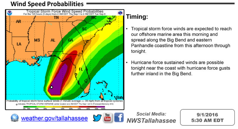
Timing:
- Storms are expected to reach the western Panhandle and southeast AL by early afternoon, and the Big Bend and southwest GA by late this afternoon into the early
2. Forecast Rain Amounts
Despite heavy rainfall in association with the storms, movement should be quick enough to inhibit flooding.
Forecast Totals:
- Ranging from 1 to 2.5 inches area-wide.
- Isolated higher amounts of 2.5 to 4 inches will be possible mainly across the western Panhandle


Be the first to comment