New map breaks down county-by-county when drivers should be more vigilant
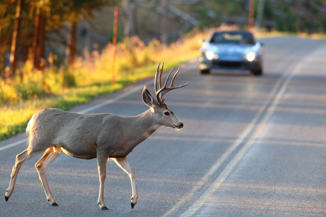
 Athens, Ga. — Fall is prime breeding season for deer across Georgia. It’s also when drivers are more likely to hit deer that run into the road, according to a new study from the University of Georgia.
UGA researchers have completed a county-by-county analysis of when motorists should be more aware of possibly hitting a deer. They looked at breeding data and then compared it to deer-vehicle collision statistics across Georgia.
According to the study, between 2005 and 2012, there were 45,811 reported deer-vehicle collisions across all Georgia counties.
Deer-vehicle collisions increase during “rutting season” because white-tailed deer move around a lot more looking for mates, according to James Stickles, lead researcher on the project. Stickles, who led the study while earning his master’s degree from UGA’s Warnell School of Forestry and Natural Resources, said researchers were able to create a map that more accurately reflects when motorists are in greater danger of hitting a deer. The new map lists specific peak dates for each of Georgia’s 159 counties.
“Now we can warn drivers in a more relevant timeframe than in the past,” said Stickles, who is now assistant deer coordinator for the Florida Fish and Wildlife Conservation Commission.
“Depending on your location in Georgia, peak rut may occur anywhere from October to December,” he said. “By knowing deer movement dates in specific areas, email blasts and other warnings to be more vigilant of deer can be distributed before, and during, times when deer-vehicle collisions are most likely to occur.”
The peak time when deer are on the movie in Southwest Georgia, according to the Georgia Rut Map, is in late November through early December.
 Recently published in the Journal of the Southeastern Association of Fish and Wildlife Agencies, the study analyzed deer-vehicle collisions from 2005 to 2012 and then compared the timing of those wrecks with available conception data, deer movement information obtained from deer wearing GPS collars in Harris County and the old “rut map” from Georgia Outdoor News.
The Georgia Department of Natural Resources is already using the new map created by UGA to inform hunters of peak rut dates. The Georgia DOT is also considering using the map to develop specific motorist warnings for each region.
But there are things motorists should do to avoid hitting a deer, said Bob Warren, a professor in the Warnell School and one of the researchers on the study.
Deer are mostly active from dusk to dawn, Warren said, so that’s when the risk of a deer-vehicle collision is greater.
“Any motorist driving at night needs to be especially cautious because deer will be more active during nighttime periods,” he said. “This is why most deer-vehicle collisions occur early in the morning or late in the evening, because that’s when deer and motorists are both most active.”
 Warren said that when he drives at night, he’s diligent about driving at a cautious speed and scanning both sides of the road because a deer can come from either direction. But he also warned that typically, it’s not the first deer that’s the problem.
Deer are rarely alone,” he said. “If a motorist sees one deer, look for the second one. In many instances, it’s the second deer that crosses the road that gets hit.”
Other researchers on this project include David Stone, Charles Evans, Karl Miller and David Osborn, all with the Warnell School; and Charlie Killmaster from the Georgia DNR. The project was funded by the Georgia DOT.
The map can be found online and downloaded at the Georgia Department of Natural Resources’ website, http://www.georgiawildlife.com/rut-map.
“Using Deer-vehicle Collisions to Map White-Tailed Deer Breeding Activity in Georgia” can be found online at http://www.seafwa.org/html/journals/pdf/30%20Stickles%20et%20al%20202-207.pdf.


Be the first to comment