
New Information:
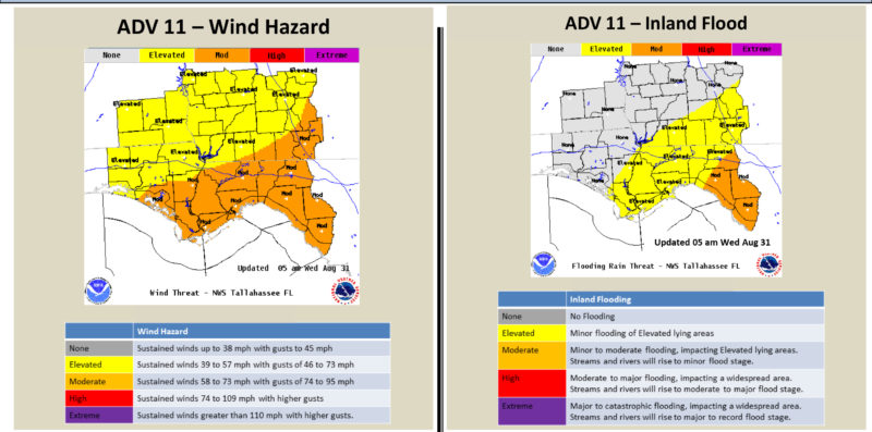
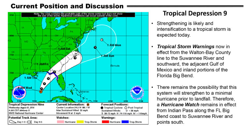
- Tropical Storm Warnings have been issued where Tropical Storm Watches were previously in effect across the Florida Big Bend, including Tallahassee, and coastal Panhandle regions. Hurricane Watches remain in effect across coastal Big Bend locations.
- The latest forecast track has shifted slightly to the west
Key Points:
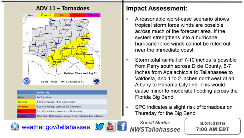
- TD 9 has become better organized in the southern Gulf of Mexico this morning, and is moving slowly northward. The latest forecast track continues to turn the system to the northeast later today, and brings it onshore in the Florida Big Bend Thursday night.
- The system is expected to strengthen, with a strong tropical storm forecast at landfall. While it will not change the forecast impacts dramatically, a minimal hurricane is not out of the question, which is the reasoning behind leaving the hurricane watch in effect.
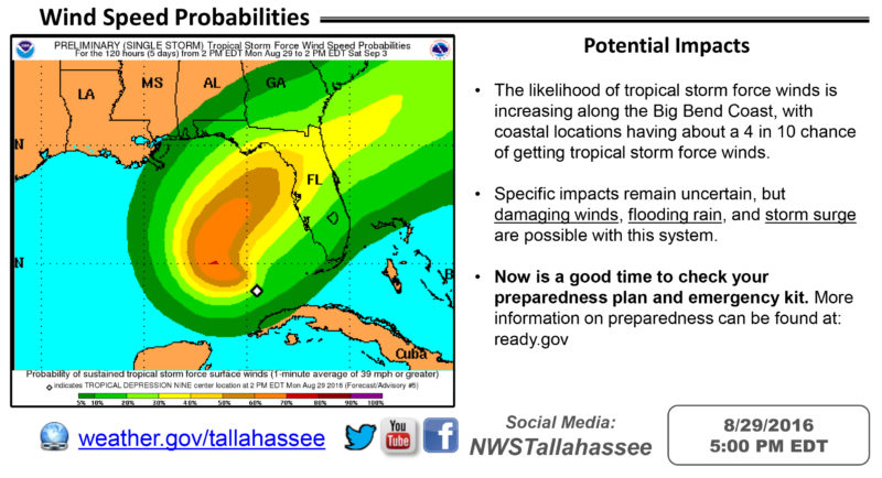
- The most significant impacts are currently expected in the Big Bend Region, with any deviation in track affecting impact location. This includes damaging winds, flooding rains, and storm surge inundation. Increased rip currents are expected in the Big Bend and portions of the Panhandle.

Be the first to comment